
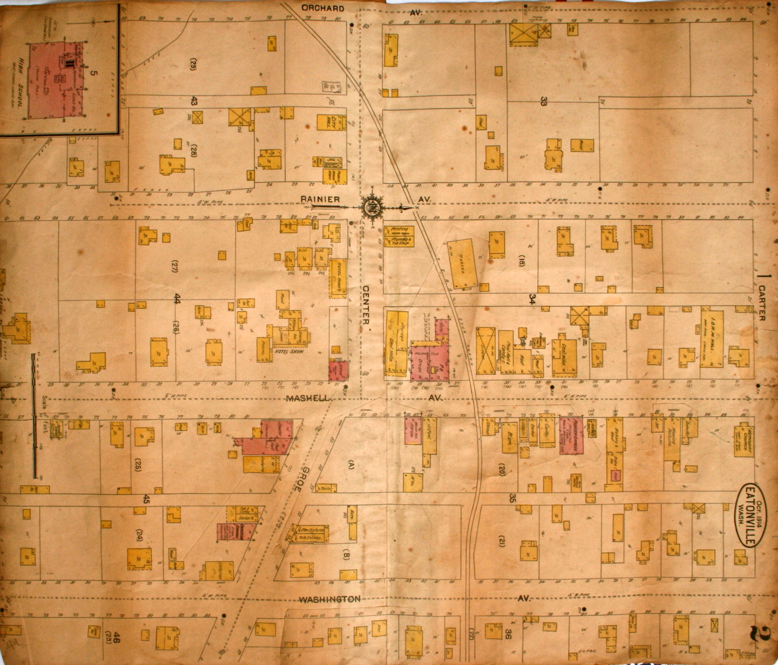
This 1914 map is broken down into three pieces.
In the first section you can see the Eatonville school, which had just been built. The second section covers downtown and you’ll immediately see Mashell Ave. and Center Street. The third section details the Eatonville Lumber mill. If you look closely, all the buildings are labeled.
Enjoy!
Courtesy of Pat Van Eaton and the Historical Society.
Click on images to enlarge.


2 responses to “1914 Map of Eatonville”
[…] 1914 image might not be completely straight or very clear, but I love everything about it, […]
LikeLike
Eatonville map 3 I am looking for the rail line found it so the question is ( Is there more of this map 3 ?
LikeLike